Navigator: Bob Reitz
Course length: 27.6 Nautical Miles (Full) / 22.6 NM (Shortened Course)
Start Time: 0900 Hrs.
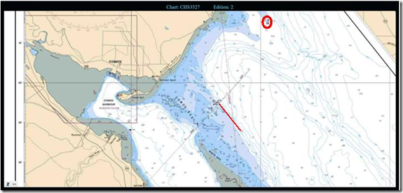
Start Line: Outside Comox Bar between red bell buoy P54 and orange flag on race Committee boat with Committee boat to starboard. The two East Cardinal buoys (PJ and PB) off Cape Lazo are marks of the course and must be left to port.
Summary of race plan with Details of Hazards:
Section 1: Start – There are two red buoys, P52 and P54 in the start vicinity. Ensure using P54 as start line. Leave buoys off Capo Lazo to port.
Section 2: Georgia Straits – No significant currents.
Section 3: Finish –
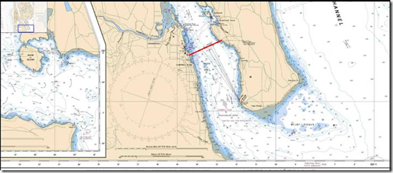
Finish Line: Line between an orange inflatable buoy on the Discovery Fishing Pier across Discovery Passage to the cell tower on Quadra Island. Shortened finish = magnetic bearing of 220 to Shelter point 49, 56.5N and 125, 11.107W
Tides and Currents for day[s] of race:
Comox
Day Time(PDT) Height(m)
2 4:34 AM 4.6
2 11:54 AM 0.9
2 7:01 PM 4.6
2 12:11 AM 3.3
Campbell River
Day Time(PDT) Height(m)
2 3:52 AM 4.1
2 11:26 AM 1.0
2 6:20 PM 3.9
2 10:30 PM 3.2
The complex lunar and solar gravitational effects that create tidal rise and fall mainly affect the open ocean. As the tidal height of the outer coast rises and falls, water moves into or out of the inside passages (this acts like our hose at the end of the ditch). In Vancouver Island’s case, the water flows in from both the north and south end of the Island, meeting just south of Mitlenatch Island (think of another ditch on the opposite side of the pond, which we are also putting water into or pumping out of). So for Campbell River area, the Flood current is a southerly flow, while from Courtenay and south, the Flood is northerly. When transiting Seymour Narrows, if possible, listen in on the Traffic Frequency, Channel 71, and you will hear any large vessels, or tugs and tows that are transiting as they make passage arrangements.


